
Eisenhower was formidable, and bald. Just like Ike in real life
The summer after my freshman year in college, a friend from home texted asking if I wanted to drive up to New Hampshire and do something called the Presidential Traverse in a single day. I said yes, in the confident and uncritical way fit 19 year olds say yes to silly physical challenges, only to injure myself playing soccer the day before and bow out of the trip. Maybe the real confident and uncritical move would have been to go regardless.
Anyway, the Presidential Traverse stuck in my mind as a feat of New England mountain adventure ever since. And a week ago, roughly eight years to the day of that initial inquiry, came a text from another friend asking the nearly-thirty version of the question: “Do you want to to do the Presidential Traverse over two days this weekend?”. With slightly more consideration this time, “Will I have to take time off work?”, “How do I get a car to drive up to New Hampshire?”, “Where will I sleep Sunday night after we finish?”, I said “Definitely!” – and we put the plan into motion. Well, a plan was already in motion and I hopped in and tried not to mess any of it up.
The crew was Alan, my backpacking pre-orientation trip counselor from college, and Storm, another counselor from that same program. I’m 29 now, did three years of that backpacking program as a counselor and several trips post college. But our relative ages stay some sense of constant and I couldn’t help at times feeling like Alan and Storm were the counselors and I was the youngin’ keeping up and trying to not foil any plans.
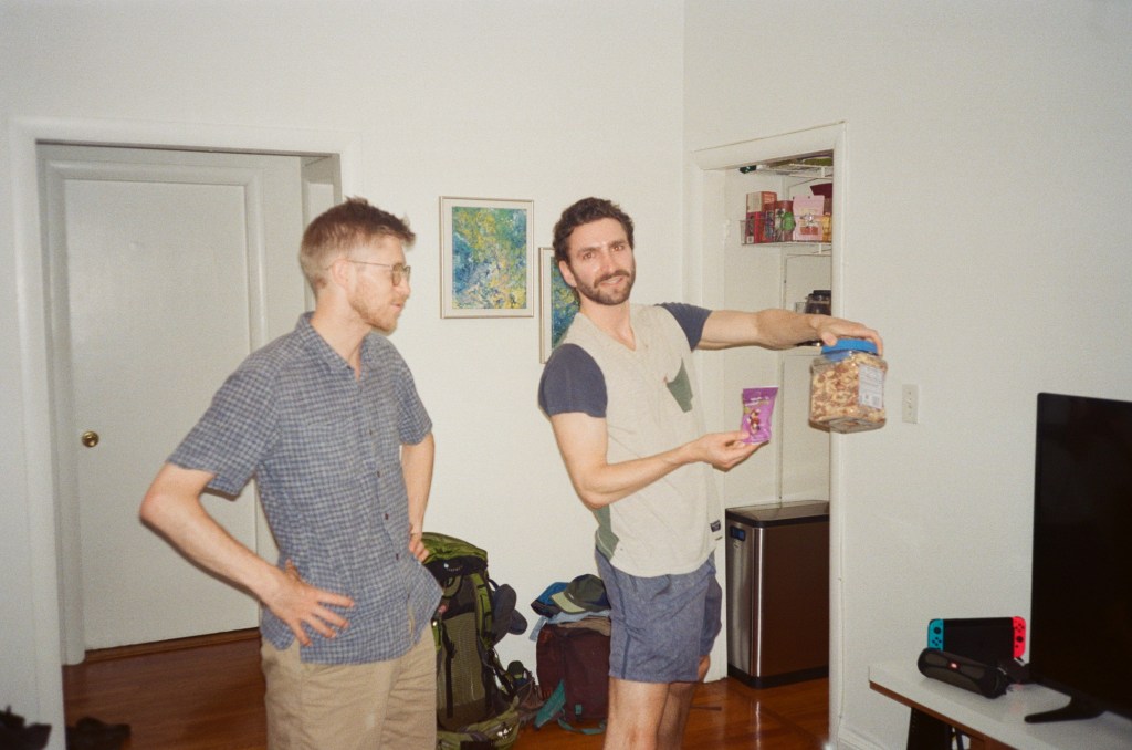
I arrived to the group chat and Alan posted a spreadsheet with tabs for the hike composition (elevation, terrain, distance, expected weather, water sources), gear, and food. There were clearly labeled sections for me to add my own gear check-list. I read through the list and developed a new mental checklist for all the items I did not own – and added a stop to my friend’s house to borrow gear, and to REI to buy some items I knew I would need.
Trekking poles were on that list. For reasons aforementioned (uncritical and confident), when I did most of my arduous hiking in college I refused to use poles. I’ll say it was a point of pride to make things slightly harder or to show that the hike was doable for me without them. I’ve happily graduated out of that mental framework — or so I think I have…I imagine there are some residual habits that stick around — and I bolded poles on that list. Something also clicked in my mind about the nature of New England hikes. My personal experience is pretty limited to the Hudson Valley and a weekend in Acadia, but from that limited sample size and general lore, the Appalachian Trail and its adjacent offshoots don’t mess about. There tend to be no switch backs, and trails tend to be collections of cobblestones or granite slabs to be scrambled up and carefully stepped down. On a trip to Acadia recently, a friend recommended we stop in Camden for a small sunset hike. We probably hiked a tenth of a mile but gained enough elevation scrambling on our hands and knees to see over the entire city, and the way down was discouragingly scary – am I really going to die slipping on a slab of granite in a quaint Maine harbor town? Maybe on this hike in the White Mountains, with heavy packs, trekking poles are more of a requirement than a suggestion…
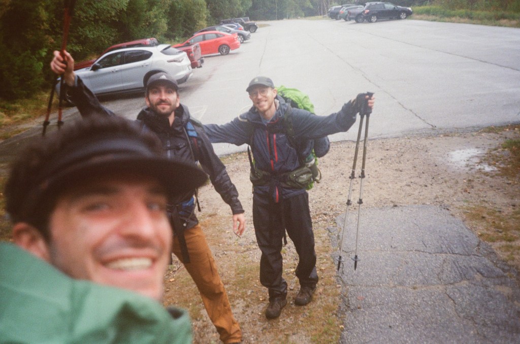
On Friday I picked up a car from my parents house in Connecticut and started the trip up to Boston. The plan was to crash in Alan’s apartment in Cambridge for the night and then drive to the trailhead early Saturday morning. After some meticulous arranging of food and gear that flowed seamlessly from Alan’s spreadsheet, we got a good night’s sleep and rose sharply at 5am. Storm had baked scones that week and handed them out to us for a to-go breakfast.
It took about two hours to arrive at the parking lot where we planned to end our trek – Mt. Clinton Road. We took one of only three remaining spots, the lot gets busy very quickly on a pleasant August weekend, and packed the remaining gear into Alan’s car. We got a bit lucky again in the next parking lot and were off on our ascent towards the first summit – Mt. Madison – by 9am. We felt good, and I felt validated for my in hand trekking poles because the hike’s ascent truly was immediate. We covered about 1,000 feet of vertical in 1.5 miles, and then I had a horrible realization. The whole point of the shuttle strategy with our cars was to ensure when we finished our trek the next day, we would be at my car in the other lot, which meant that I needed my keys, which I had thoughtlessly left inside of Alan’s car. I announced the bad news to our group and decisively dropped my pack, took Alan’s keys, and started a soft trail run back to the car. Alan and Storm told me to take my time, and to take care to not twist my ankle, but I also knew that we were slightly tight on timing.
I rushed by group after group like a maniac, galloping forward using my trekking poles to try and retrieve the keys under an hour. I remembered how my sisters would get me to do things for them by saying, “we’ll time you!”. I enter into a mindless state of forward movement when the task is as simple as this, so it was kind of meditative and fun. All the groups I passed on the way down laughed as they saw me hurrying back up the trail after I got the keys from Alan’s car. I think they thought I was sprinting a through hike of the entire traverse in one day.
As I neared the mossy grove near where Alan, Storm, and I had paused I heard Alan yodel out to me – I yodeled back and ten seconds later I reached them and handed over the keys. They told me how fast I was, which also reminded me of my sisters patting me on the head showing me my speedy time on their watches, and I slowly realized that I was now exhausted. 1.5 miles into our trip, I had covered 4.5 and twice the vertical, not to mention the strain that comes from the steep descents. I ate a quick lunch – a maple syrup packet for some instant sugar and a protein bar. We had to get going. I felt very acquainted to the Valley Way trail after this,
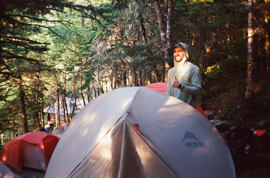
The Presidential Traverse involves climbing seven summits named after different presidents. Madison, Adams, Jefferson, Washington, Monroe, Eisenhower, and Pierce. One of the reasons that people do attempt the traverse over one day is that near some of the summits are huts that have been maintained for a century – offering bunk rooms, fresh water, baked goods, and a respite from the traverse’s common mist, wind, and thunderstorms. Not to mention the odd banjo player. The Madison hut is one of the more famous because of its accessibility from the parking lot, Storm had actually been there once before when he was about fifteen. Teenagers vie for coveted roles as hut aides, and hike up food and fuel on make shift backpacks of wooden boards and rope that seem fifty years old. And judging by some black and white photos of the original aides from the forties, they were.
‘The cuteness of the spring huts and a brief water break before properly summitting Madison were much needed injections of life for me. I probably should have taken a longer break in between my key retrieval and our hiking restart. We left our packs at the hut and traversed a sea of mossy boulders to reach the summit. The trail is more just an orientation – a lineage of rock cairns spaced fifty feet apart from each other nudges you to stay on a certain path. But step by step the trail is non-existent. Storm would pause every now and then and take his phone out to use Merlin, the Shazam for bird calls – and he went on a rant about how Bald Eagles really don’t sound like the way they do in movies, which are recordings of red trailed hawks – in some cultures they called Bald Eagles “Alaska Pigeons”. “they aren’t the best hunters themselves, but they are a large bird, so they’ll typically wait for the osprey to kill their prey and then they will intimidate and fight off the osprey.” I thought about it for a second, “that metaphor is a little on the nose.”
We climbed up the desolate pile of boulders and gazed around the panorama. One downside to not being involved in the planning of a trip is that I’m completely disoriented. Beauty is beauty, I don’t need to know the name of every hill I’m gazing out onto to appreciate where I am, but I felt this apprehension that I was in this beautiful place and had truly no idea of what direction I was looking out onto. Note to myself for next time – try to get somewhat acquainted with the area to feel a bit more context when you are up high looking out onto a vast expanse.
Mt. Adams is just on the other side of the Madison hut. So we came back down, grabbed our packs, and continued on. We headed towards Mt. Adam’s, opting for a route that initially took us around the peak, so that we could drop packs again and do an out and back top out. Again, the path to the top was a collection of stones. Patrons of the mountain were strewn about choosing their own adventures to get up and down. Every once in a while we would see a speedier solo hiker or duo making their way through the single day traverse. One older trail runner on his descent overheard me mention that we had ditched the packs at the bottom and he shouted, “did I hear free stuff???!!” And he scurried along. I missed mountain culture and the childishness it brings out in people. New York is magical but often loses sight of everything outside of it. Humanity is front and center there, whereas up in the mountain humanity is a small speck in a vast Ocean of nature. The goofy older men and genial hikers are part and parcel of such a culture – contrasted with their hurried and starched contemporaries in Manhattan.
We returned to our packs and marched onwards. The next stop was our campsite, called The Perch, where we could only hope there was space in the lean-to or one of the tent platforms. This next section, from Adams to the perch, was the crux of the trip’s challenge. It was nothing complicated, just one step at a time, but each step was onto an angled block of stone that gnarled our feet. I wanted to look up at the views, but feared instantly tripping over a mini boulder or twisting my ankle. There was no way forward but staring down, poking with the trekking poles, finding the right place to calmly place my shoe.
We were looking for a spur trail called Israel Pass. The trail likes to mess with your head a bit with intermittent signs designating the distance to the next stop on your trek – we passed one junction that said Israel Pass was 0.4 miles away. The problem with these distances is that they’re measured longitudinally, like how a bird flies, which doesn’t take into account the steepness of the descent or ascent, or more importantly the mental exhaustion of looking down and taking care with each step onto awkwardly shaped rock. My earlier keys debacle caught up to me and my body, and I was painfully aware of how long things were taking. Time does not pass by as quickly if you’re staring at a virtual clock or odometer waiting to hit a certain distance covered.
Unfortunately, once we arrived at Israel Pass it was obvious that the Perch campsite was still a distance away. We were in the alpine zone, above the treeline and it was way too windy for any campsite. A beautiful ravine stood before us, mainly beautiful because of the dense forest that started hundreds of feet below us. Somehow this trail would be descending us down into that forest. We walked on, and soon entered a steep stone staircase that brought us down into forest. Depleted and ready for bed, we arrived to the Perch around 6pm, only to find that there was no room at the inn. The lean to was packed full, and each platform had a tent or two already set up. The lean-to residents told us that a few groups had passed by before us, and continued on the trail to a log cabin about a mile further where there was also not guaranteed to be space. After our lengthy day we decided to rely on the goodness of our fellow camp residents, and we asked two groups from two different platforms if they would be willing to shuffle their shelters over to make room for one more tent. Everyone was super kind about it and were able to find some suitable space to sleep. Another point in the people are generally good column.
I won’t go into much detail but later that night, one boy from a family group camping had a terrible seizure, and then another in the middle of the night, and another in the morning. It was sad to listen to, and even more challenging to witness for Alan who rushed over to see if he could be of any help to the father and other two siblings. The seizure presented a challenging question the next morning – ought the group try to pack out themselves and coax the boy who suffered down the mountain on his two feet? Or is this the right moment to call emergency services, despite the possible cost incursion. I found myself frustrated, because it seemed like the obvious time to call emergency services. A boy had a seizure, and his father, who seemed quite capable, was not Superman and surely would struggle to bring his son down steep and arduous terrain. Doing this could even introduce further risk of injury to another member of the group – and the uncertain possibility of another seizure during the hike was terrifying to me. What if he was uncontrollable and fell down the steps and endured serious injury? The number of risks and probability of one coming to actuality seemed much too high to rely on the goodwill of our group, or the group in the lean-to who ultimately volunteered to bring some of the family’s gear down the mountain. It was heartening to see everyone demonstrate true kindness and sympathy – but also frustrating that the cost of our healthcare system was likely messing with the ultimate goal of keeping everyone physically and mentally safe. The calculation is even nonsensical – perhaps we might avoid calling emergency services because of the known cost, and instead we take ambiguous risk that has the potential to escalate the cost even further (not just a rescue, but a broken leg recovery or brain related surgery). It’s entirely impossible to know the heightened probability of furthered harm from choosing to hike down the boy without professionals – but I found myself struggling to imagine putting that fate into the hands of anyone that was not EMS. Safety in the backcountry, or any part of the country, should not be priced out.
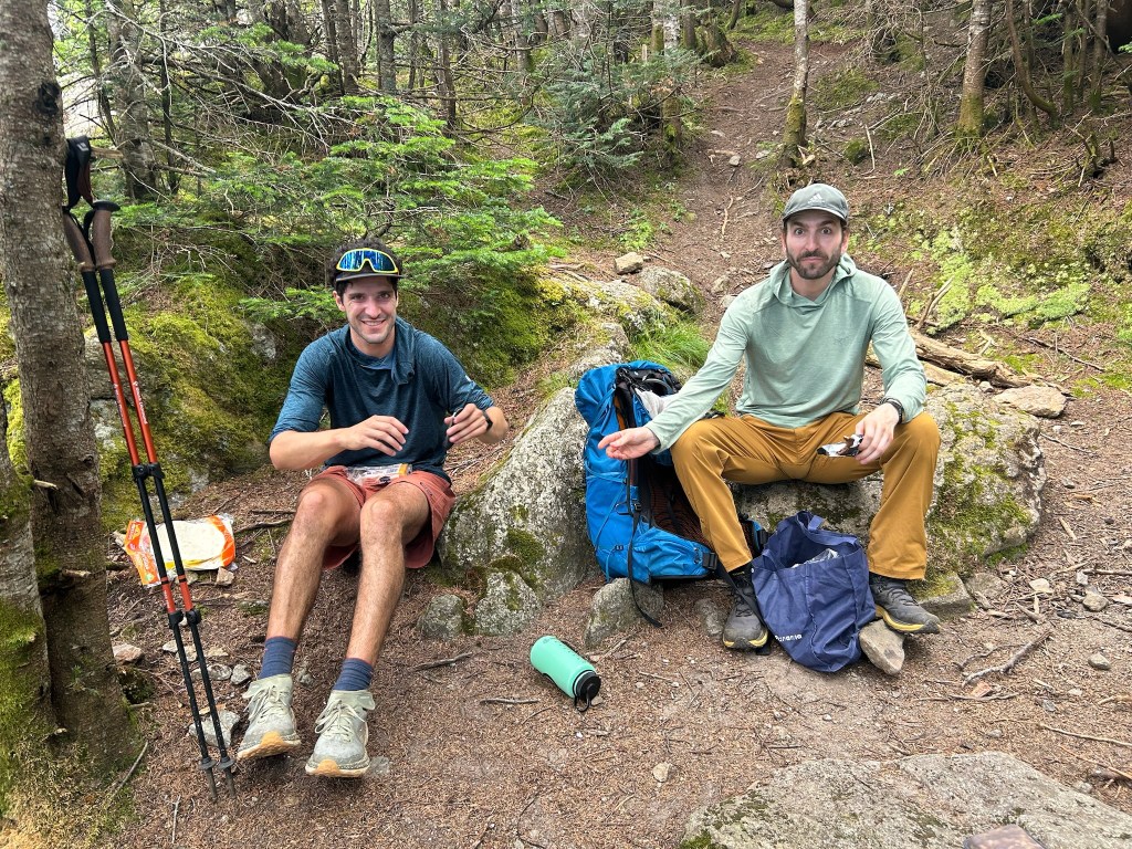
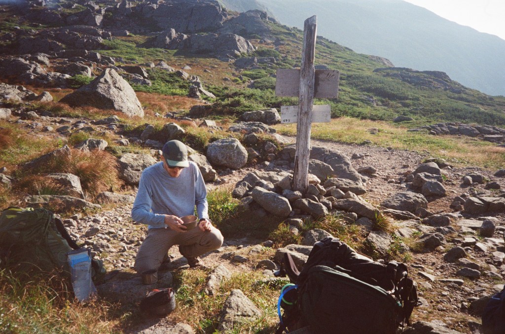
We tried to eat as many calories as possible at dinner, which I found challenging as I practically passed out into my freeze dried pad Thai. I fell asleep within two minutes of lying down on my sleeping pad, Alan told me the next morning. Day 2 was the bulk of our summits: Jefferson, Washington, Eisenhower, Pierce. And the bulk of our distance covered: ~15 miles compared to 8. The good news though, was that we would be hiking up to the ridge line and spending the day on more even ground rather than on a perpetual stony ascent.
From the get go, the day was simply more pleasant than the prior. Our climb out of the Perch felt much faster on the up than on the down. I think its just less nerve wracking when you’re not staring down into a tumbling abyss. Once out of the Perch, and out of Israel Pass, we took a longer breakfast in the sunrise. Double Kodak oatmeal with cold water reminded me how everything tastes better during a backpacking trip. I was already looking forward to a tortilla, tuna, cheese block sandwich at lunchtime.
As we crawled down Jefferson, we saw a few other groups from our campsite – a couple of solo hikers, a group of Quebec hikers, and a couple trail running the whole traverse. I find people form Quebec funny, and to the degree its appropriate to make cultural generalizations, I find them pretty lame. You’re not actually French! France does not care much about you! Get over yourselves, Quebec! Just be Canadian! Be cool, like Vancouver!
From the base of Jefferson we stared off towards Mt. Washington, which stood atop Tuckerman’s Ravine. I knew Tuckerman’s from East Coast ski lore – it’s a prominent backcountry skiing spot with some of the steepest and scariest lines out there, deaths are not uncommon. I thought about making the pilgrimage up here in the winter to check it out and I have to say that after seeing the ravine in person I might think twice! Man was it steep. I figured some of the more aggressive looking parts were untouched areas, but a black and white photo we saw in one of the huts made it clear that those are ski lines with regular avalanche slides. Gave me the shivers. But it was a gorgeous sight to adorn the hike across from Jefferson up to the highest peak in the Northeast.
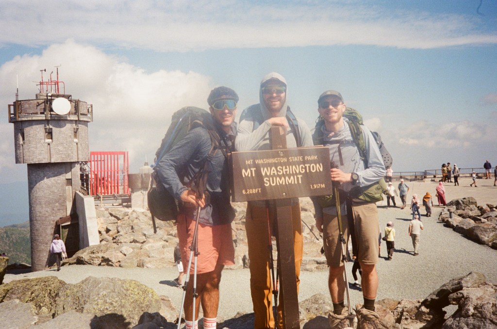
A tram goes up Washington like a Wes Anderson set design, and cars climb it via a paved road. The summit, like a few parts of this hike and many parts of East Coast hikes, was a bit displacing from true backcountry. In California I often felt truly alone or far, far away from society. On Mt. Washington or in the huts with fully stacked snack stations (gruelingly muled up by volunteering teenagers), it felt like we could dial up mommy if things got too difficult. But there was also a magic added to being halfway in the backcountry and halfway in a touristy spot. The tram waved at us on its steep ascent up the Washington nose, and one man with a baby in his arm gave Alan a fierce fist bump, “you got this!” He seemed to shout. Alan raised his arm in response and with an adrenaline kick hoisted himself up to the next stone and then the next. Soon we were climbing over the peak, ducking our heads to avoid ruining the selfies and panoramas from the industrial complex of the summit.
We filled our water on Mt. Washington and enjoyed a well earned lunch of hot chili tuna and sharp cheddar tortilla wraps, with a peanut butter tortilla wrap for dessert. As we finished eating, the accelerating winds shrouded our panoramic view of the mountains in thick fog. The temperature dropped ten degrees, instantly reminding us of how lucky we’d been with the weather so far. We all put our rain gear near the top of our packs, threw on jackets, and restarted our hike as soon as we could. Next up was Monroe.
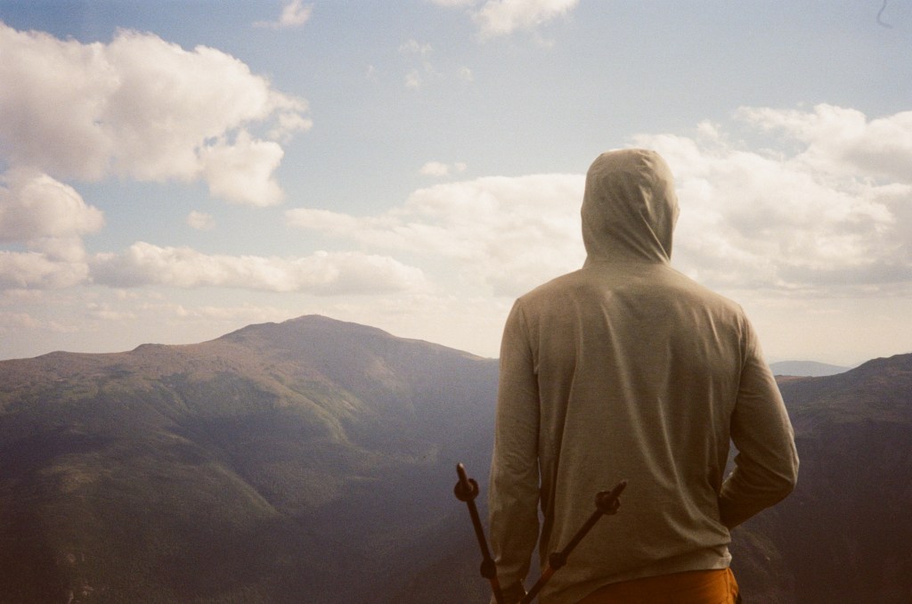
The next stetch of the hike, from Washington through Pierce, was tremendous. The fog rolled out as quickly as it rolled in, revealing a sun laden stretch of ridge line trail undulating over the heads of Monroe, Eisenhower, and Pierce. We were used to looking down at the next step onto crickety boulders, and now we were staring towards the textured vista of our new journey. After the prior day of hiking, I had no expectations of anything for this trip outside of grueling stairmaster lunges into bleak views. In the distance part of the trail even looked evenly set on dirt patches, rather than uneven stone.
And so it was! For a few glorious steps as we summitted the next couple of peaks the terrain did even out. It will be impossible to retain that gratitude on another hike where, surely, the trail composition is less variable and animalistic. But it was palpable in this stretch, every one of those patches of soft, forgiving soil I remember fondly.
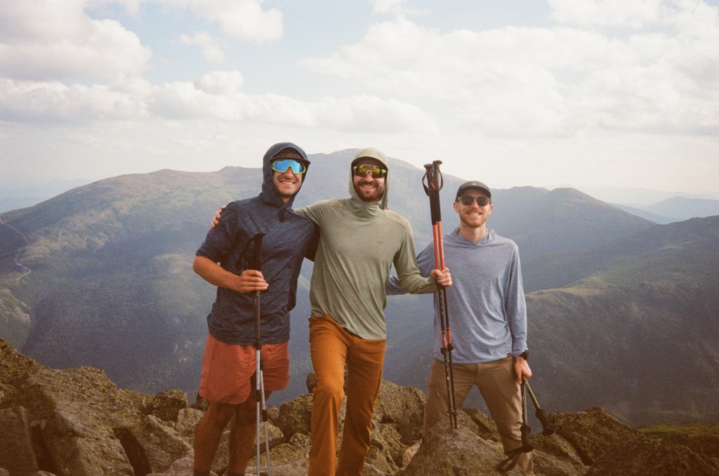
My favorite peak was Eisenhower. As we mounted Monroe after Washington, Eisenhower’s tree-less and rounded peak loomed in the distance. It looked reasonably close, but I made a prediction that our eyes deceived us and that in the opaque in-between would be a challenging section, and that the climb up would not be straight forward. Ike was indeed bald and formidable. And reaching his bald cap, we were tired and gratified. Alan pushed us to take the climb briskly because of the looming dark clouds – we did not want to be caught on top of one of the higher peaks in the range during a thunderstorm. Fortunately we got to enjoy some views, the clouds had moved on by, when we arrived up top.
The remainder of the peaks were undulating atop the ridge, there were no more true challenges of steepness. Our final summit of Pierce was completely anti climactic – after a peaceful stretch along a pair of parrallel wooden planks in a mossy forest, we realized we conquered the seventh peak. Our slow descent was now before us.
We stopped briefly in Mitfah hut and it began to rain. The hut workers urged us forward that we ought to get going and finish our hike before the storm truly hit. They assured us though that we had enough light and that our plan was sound. Rain jackets on, we hit the trail. I predicted mentally that this last stretch, though short, would probably feel longer than we wanted it to. And it sort of did! But mostly it was a kind stretch of trail, not too sharp in it’s descent. We got to reminisce on our trip and laugh in the rain. We recommended books to each other, Alan told me to read “How to be a Stoic”, which I plan to pick up soon. I recommended “A Swim in the Pond in the Rain” by George Saunders.
Nothing dramatic occurred in this final stretch, and we arrived directly to my car. We cheered and hugged, a rush of endorphins congratulated me like confetti – this was one of the harder efforts of the year. Just like a long bike ride two weeks prior, this trip made me grateful for my arrival back in the East Coast. I’ve traded Oceanside switch backs for Adirondack rock scrambles, and I gained back my favorite adventure pals. I am so happy.
I would not say I am hooked on AT hikes – I don’t even know if I am interested in pursuing the 48 peaks over 4k feet. I’ll take them as they come. But boy do I have a respect for these mountains and the grit they ask for in exchange for wonderful views and ancient alpine terrain. This is the oldest hiking trail in the country, amidst one of the oldest mountain ranges on the planet. I’m thankful for all the wisdom.

Leave a comment